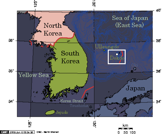
File:Map of Dokdo.png
Jump to navigation
Jump to search
No higher resolution available.
Map_of_Dokdo.png (517 × 430 pixels, file size: 54 KB, MIME type: image/png)
File history
Click on a date/time to view the file as it appeared at that time.
| Date/Time | Thumbnail | Dimensions | User | Comment | |
|---|---|---|---|---|---|
| current | 19:57, 11 March 2022 | | 517 × 430 (54 KB) | Maintenance script (talk | contribs) | == Summary == Importing file |
You cannot overwrite this file.
File usage
The following 2 pages use this file: