Mission La Purísima Concepción/Gallery
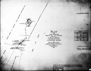
© Diagram: U.S. Land Surveyor's Office
The "Alemany Plat" prepared by the U.S. Land Surveyor's Office to define the property restored to the Catholic Church by the Public Land Commission, later confirmed by presidential proclamation in 1874.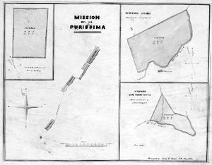
(PD) Diagram: U.S. Land Surveyor's Office
A land survey conducted in 1854 documented the orchard and vineyards associated with Mission La Purísima Concepción.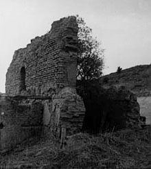
(PD) Photo: Keystone-Mast Company
The chapel at Mission La Purísima Concepción in ruins, circa 1900.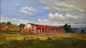
(PD) Painting: John Sykes
The Mission La Purísima Concepción compound as it stood in 1908.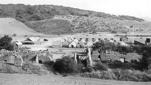
(PD) Photo: National Park Service
The ruins of the original chapel at Mission La Purísima Concepción in 1934. The Civilian Conservation Corps encampment can be seen in the background.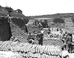
(PD) Photo: National Park Service
A Civilian Conservation Corps crew places adobe blocks at Mission La Purísima Concepción's chapel in 1935.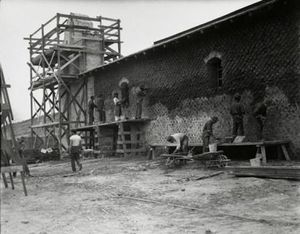
(PD) Photo: National Park Service
Civilian Conservation Corps crew members apply cement plaster to the adobe chapel walls at Mission La Purísima Concepción.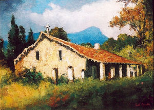
(PD) Painting: Will Sparks
The monastery at Mission La Purísima Concepción, between 1933 and 1937.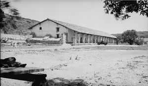
(PD) Photo: Henry F. Withey / Historic American Buildings Survey
The monastery at Mission La Purísima Concepción in 1937.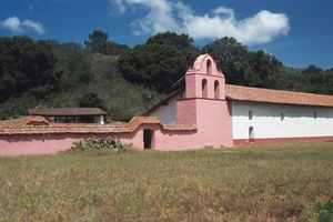
(CC) Photo: Larry Myhre
The reconstructed Mission La Purísima Concepción in April, 2003.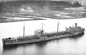
(PD) Photo: United States Navy
USNS Mission Purisima (T-AO-118) at sea, date and location unknown.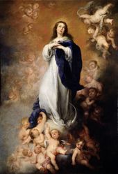
(PD) Painting: Bartolomé Esteban Murillo
The Immaculate Conception of Mary.


