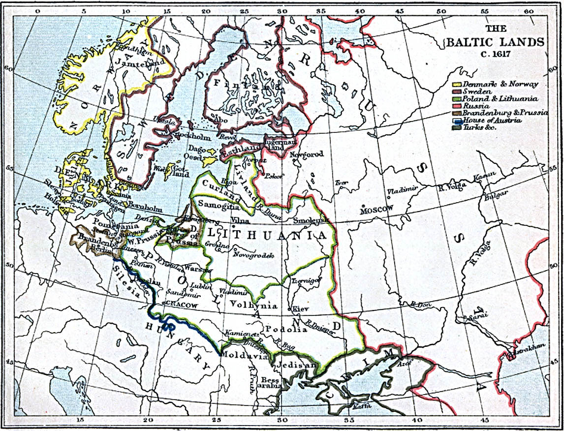
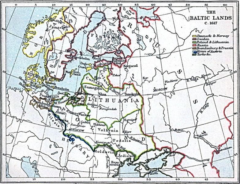
File:1617balt.jpg
Jump to navigation
Jump to search
Size of this preview: 784 × 599 pixels. Other resolution: 1,146 × 876 pixels.
Original file (1,146 × 876 pixels, file size: 310 KB, MIME type: image/jpeg)
Summary
map of Baltic area 1617
(Freeman's Historical Geography, 1903), at [1]
![[1]](http://www.lib.utexas.edu/maps/historical/baltics_1617.jpg)
Licensing/Copyright status
This media, 1617balt.jpg, is in the public domain
You may freely copy, distribute, display and perform this work, as well as make derivative and commercial works.
File history
Click on a date/time to view the file as it appeared at that time.
| Date/Time | Thumbnail | Dimensions | User | Comment | |
|---|---|---|---|---|---|
| current | 19:51, 11 March 2022 | | 1,146 × 876 (310 KB) | Maintenance script (talk | contribs) | == Summary == Importing file |
You cannot overwrite this file.
File usage
The following page uses this file: