File:NPS cumberland-gap-geologic-map-west.jpg
Jump to navigation
Jump to search


Size of this preview: 800 × 552 pixels. Other resolution: 2,188 × 1,511 pixels.
Original file (2,188 × 1,511 pixels, file size: 887 KB, MIME type: image/jpeg)
Summary
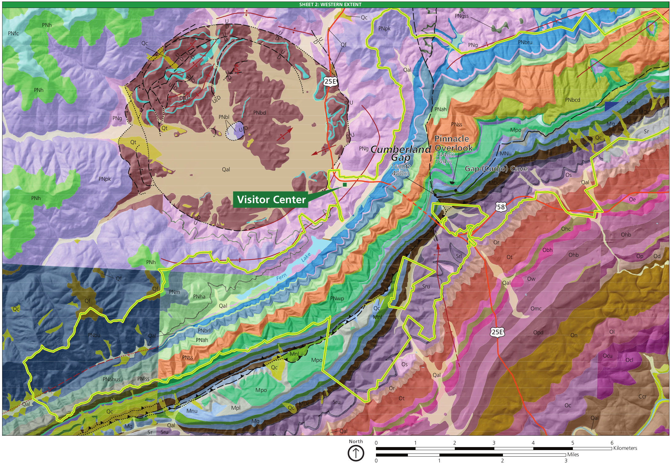
| Description |
English: The west Cumberland Gap geologic map shows the unique geology of the park in the area surrounding the visitor center off Highway 25E. You can view a legend on the map above. |
| Date | |
| Source | U.S. National Park Service (http://npmaps.com/wp-content/uploads/cumberland-gap-geologic-map-west.jpg) |
| Author | U.S. National Park Service, restoration/cleanup by Matt Holly |
Licensing
| This image or media file contains material based on a work of a National Park Service employee, created as part of that person's official duties. As a work of the U.S. federal government, such work is in the public domain in the United States. See the NPS website and NPS copyright policy for more information. |
File history
Click on a date/time to view the file as it appeared at that time.
| Date/Time | Thumbnail | Dimensions | User | Comment | |
|---|---|---|---|---|---|
| current | 15:16, 16 May 2017 | | 2,188 × 1,511 (887 KB) | imagescommonswiki>RKBot | =={{int:filedesc}}== {{Information |description= {{en|1=The west Cumberland Gap geologic map shows the unique geology of the park in the area surrounding the visitor center off Highway 25E. You can view a legend on the map above.}} |date= 2017-01-21 |s... |
File usage
The following file is a duplicate of this file (more details):
- File:NPS cumberland-gap-geologic-map-west.jpg from Wikimedia Commons
The following page uses this file: