Search results
Jump to navigation
Jump to search
File:Orthographic projection centred on the South Sandwich Islands.png ...= This map was created using [http://www.aquarius.ifm-geomar.de/omc/ this tool].(488 × 487 (17 KB)) - 19:01, 29 April 2022
File:Orthographic projection over Grise Fjord.png ...ade using this [http://www.aquarius.ifm-geomar.de/omc/ online map creation tool].(488 × 487 (12 KB)) - 12:13, 29 April 2022
File:Yukon - Kluane Park and Alaska Highway area.png ...= This map was created using [http://www.aquarius.ifm-geomar.de/omc/ this tool].(514 × 553 (12 KB)) - 17:51, 29 April 2022
File:Alaska north shore.png ...= This map was created using [http://www.aquarius.ifm-geomar.de/omc/ this tool].(513 × 461 (19 KB)) - 19:14, 29 April 2022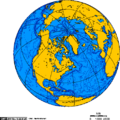
File:Orthographic projection centered over Iqaluit with latitude and longitude.png ...ade using this [http://www.aquarius.ifm-geomar.de/omc/ online map creation tool].(488 × 487 (21 KB)) - 16:00, 29 April 2022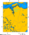
File:Lambert Projection showing Bathurst Inlet, Nunavut, and environs.png ...= This map was created using [http://www.aquarius.ifm-geomar.de/omc/ this tool].(514 × 622 (22 KB)) - 19:35, 29 April 2022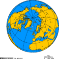
File:Jan Mayen orthographic.png ...ade using this [http://www.aquarius.ifm-geomar.de/omc/ online map creation tool].(488 × 487 (13 KB)) - 16:43, 29 April 2022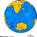
File:Orthographic projection centered on the Prince Edward Islands.png ...= This map was created using [http://www.aquarius.ifm-geomar.de/omc/ this tool].(488 × 487 (33 KB)) - 19:06, 29 April 2022
File:Orthographic projection centred on the Avalon Peninsula.png ...ade using this [http://www.aquarius.ifm-geomar.de/omc/ online map creation tool].(488 × 487 (21 KB)) - 15:47, 29 April 2022
File:Deep-water ports on North America's west coast, connected to the rail grid.png ...eated using this [http://www.aquarius.geomar.de/omc/ online map creation ] tool.(514 × 556 (38 KB)) - 21:31, 19 April 2022
File:Churchill river newfoundland and churchill falls.PNG ...= This map was created using [http://www.aquarius.ifm-geomar.de/omc/ this tool].(514 × 423 (18 KB)) - 19:10, 29 April 2022
File:Cape breton island.png ...= This map was created using [http://www.aquarius.ifm-geomar.de/omc/ this tool].(514 × 562 (16 KB)) - 19:09, 29 April 2022
File:Orthographic projection centred over Bremen and the Weser watershed.png ...ade using this [http://www.aquarius.ifm-geomar.de/omc/ online map creation tool].(488 × 487 (12 KB)) - 12:21, 29 April 2022
File:Polar siberia.png ...ade using this [http://www.aquarius.ifm-geomar.de/omc/ online map creation tool].(488 × 487 (23 KB)) - 12:08, 29 April 2022
File:Orthographic projection centred over Churchill, Manitoba, Canada.png ...ade using this [http://www.aquarius.ifm-geomar.de/omc/ online map creation tool].(488 × 487 (21 KB)) - 12:20, 29 April 2022
File:Lambert Projection showing the Diavik Diamond Mine, near Barthurst Inlet, Nunavut.png ...= This map was created using [http://www.aquarius.ifm-geomar.de/omc/ this tool].(514 × 622 (23 KB)) - 18:00, 29 April 2022
File:Lambert Projection showing the Ekati and Diavik Diamond Mine, near Barthurst Inlet, Nunavut.png ...= This map was created using [http://www.aquarius.ifm-geomar.de/omc/ this tool].(514 × 516 (30 KB)) - 17:58, 29 April 2022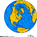
File:Orthographic projection over Labrador City.png ...ade using this [http://www.aquarius.ifm-geomar.de/omc/ online map creation tool].(488 × 487 (21 KB)) - 12:12, 29 April 2022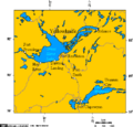
File:Great Slave Lake and Lake Athabasca 6.png ...= This map was created using [http://www.aquarius.ifm-geomar.de/omc/ this tool].(514 × 493 (19 KB)) - 19:31, 29 April 2022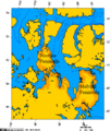
File:Boothia and melville peninsula 1.PNG ...= This map was created using [http://www.aquarius.ifm-geomar.de/omc/ this tool].(514 × 613 (72 KB)) - 19:15, 29 April 2022


