Search results
Jump to navigation
Jump to search
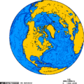
File:Orthographic projection centered over Iqaluit.png ...ade using this [http://www.aquarius.ifm-geomar.de/omc/ online map creation tool].(488 × 487 (18 KB)) - 15:48, 29 April 2022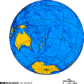
File:Orthographic projection over Raoul Island.png ...= This map was created using [http://www.aquarius.ifm-geomar.de/omc/ this tool].(488 × 487 (20 KB)) - 18:13, 29 April 2022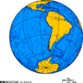
File:Orthographic projection centred over Juan Fernandez.png ...= This map was created using [http://www.aquarius.ifm-geomar.de/omc/ this tool].(488 × 487 (19 KB)) - 09:14, 29 April 2022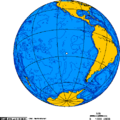
File:Orthographic projection centred over Easter Island.png ...= This map was created using [http://www.aquarius.ifm-geomar.de/omc/ this tool].(488 × 487 (19 KB)) - 18:04, 29 April 2022
File:Orthographic projection over Vladisvostok.png ...ade using this [http://www.aquarius.ifm-geomar.de/omc/ online map creation tool].(488 × 487 (21 KB)) - 12:09, 29 April 2022
File:Orthographic projection centred over Kerguelen Island.png ...= This map was created using [http://www.aquarius.ifm-geomar.de/omc/ this tool].(488 × 487 (21 KB)) - 19:00, 29 April 2022
File:Watershed of the Saskatchewan River.png ...= This map was created using [http://www.aquarius.ifm-geomar.de/omc/ this tool].(513 × 382 (33 KB)) - 17:53, 29 April 2022
File:Orthographic projection centred over Ross Island.png ...= This map was created using [http://www.aquarius.ifm-geomar.de/omc/ this tool].(488 × 487 (21 KB)) - 18:58, 29 April 2022
File:Orthographic projection centred over the Bounty Islands.png ...= This map was created using [http://www.aquarius.ifm-geomar.de/omc/ this tool].(488 × 487 (20 KB)) - 18:15, 29 April 2022
File:Orthographic projection centred over South Georgia Island.png ...= This map was created using [http://www.aquarius.ifm-geomar.de/omc/ this tool].(488 × 487 (17 KB)) - 18:17, 29 April 2022
File:Orthographic projection over Qaanaag.png ...ade using this [http://www.aquarius.ifm-geomar.de/omc/ online map creation tool].(488 × 487 (12 KB)) - 12:11, 29 April 2022
File:Orthographic projection centred over Fernando de Noronha.png ...= This map was created using [http://www.aquarius.ifm-geomar.de/omc/ this tool].(488 × 487 (19 KB)) - 18:02, 29 April 2022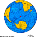
File:Orthographic projection centered over Bouvet Island.png ...= This map was created using [http://www.aquarius.ifm-geomar.de/omc/ this tool].(488 × 487 (35 KB)) - 19:02, 29 April 2022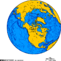
File:Orthographic projection over Bathurst Inlet, Nunavut.png ...ade using this [http://www.aquarius.ifm-geomar.de/omc/ online map creation tool].(488 × 487 (29 KB)) - 12:14, 29 April 2022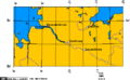
File:Map of cuxhaven hamburg lauenburg lubeck.png ...= This map was created using [http://www.aquarius.ifm-geomar.de/omc/ this tool].(514 × 318 (5 KB)) - 17:48, 29 April 2022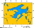
File:Great Bear Lake.png ...= This map was created using [http://www.aquarius.ifm-geomar.de/omc/ this tool].(514 × 426 (12 KB)) - 19:18, 29 April 2022
File:Orthographic projection centred over King George Island.png ...= This map was created using [http://www.aquarius.ifm-geomar.de/omc/ this tool].(488 × 487 (20 KB)) - 18:58, 29 April 2022
File:Yukon - Kluane Park and Alaska Highway area.png ...= This map was created using [http://www.aquarius.ifm-geomar.de/omc/ this tool].(514 × 553 (12 KB)) - 17:51, 29 April 2022
File:Orthographic projection centred over Wallis and Futuna Islands.png ...= This map was created using [http://www.aquarius.ifm-geomar.de/omc/ this tool].(488 × 487 (20 KB)) - 18:16, 29 April 2022
File:Orthographic projection over the larsen b ice shelf.png ...= This map was created using [http://www.aquarius.ifm-geomar.de/omc/ this tool].(488 × 487 (20 KB)) - 18:11, 29 April 2022


